October 26 – Written By Michael Sparks
Under the Radar and Running Out of Time: Climate Change is Coming for Delmarva
Sinking Land, Rising Seas, Eroding Coasts, Massive Floods, and Enormous Storms Are Hitting Delmarva All At Once
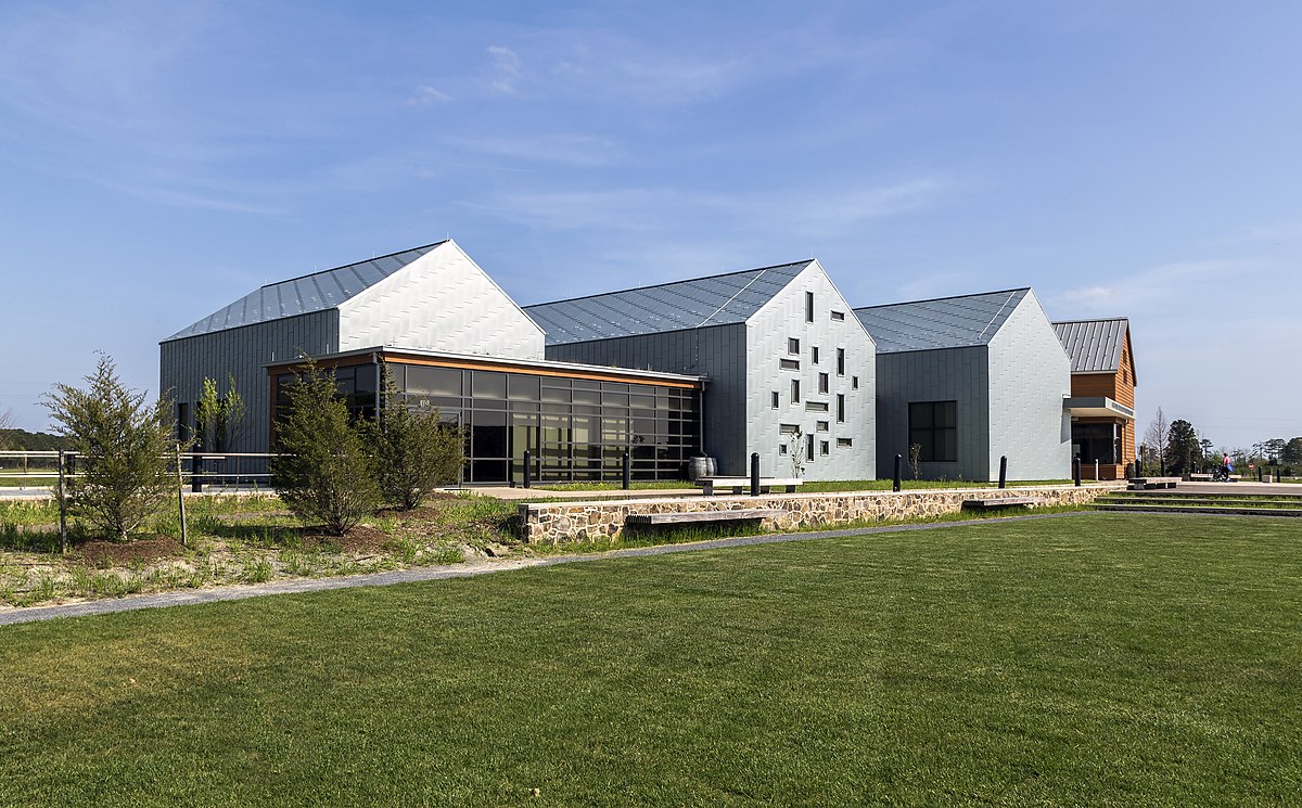
CAMBRIDGE, MD – There are several posters hanging on the wall of the Harriet Tubman National Historical Park, listing out 70 names in all. Names like “Kessiah Jolley Bowley” and “Araminta Bowley (baby):” these are the people Harriet Tubman helped bring to freedom. Most American children learn about the Underground Railroad, but, like all history lessons, it has to overcome the challenge of feeling abstract and “long ago.” That’s why this park is so unique. Relatively undeveloped and undisturbed, "These are the very forests, if Harriet Tubman were here today, none of this landscape would have looked different to her at all," Park Superintendent Deanna Mithchell told ABC News last year.
Standing in the parking lot, with loblolly pine forests and flat lands on all sides, Martin Smiley wanted his family to understand just how brave Tubman really was. Mr. Smiley, of Virginia, was there with his wife, teenage daughter, and daughter’s friend. They were in the middle of multi-day educational roadtrip to learn more about Tubman and America’s history of slavery. “Teenagers have a tendency to pull up everything on their phone,” he said, “so it’s very important for them to see” first-hand.
But the opportunity to learn that history first-hand is at risk. Not because of politics or educational funding, but because of climate change.
Not without merit, the western United States gets almost all of the media coverage on climate change. California is forever on fire. The Pacific Northwest was over 115 degrees Fahrenheit this summer. There’s a historic drought in the Southwest. And what coverage doesn’t go to the west tends to, again, not without merit, go to the gulf states. Miami is sinking. New Orleans has sunk. Houston is on its way there.
There’s one area of the country, though, that, despite being a critical economic and cultural hub, and, despite also suffering mightily from the impacts of climate change, perhaps more so than any other area on the east coast, gets very little coverage. So little, in fact, that most Americans outside of the region probably don’t even recognize its name.
Delmarva is a 170-mile long peninsula in the mid-Atlantic region that encompasses much of the state of Delaware, the Eastern Shore of Maryland, and parts of Virginia. With a population of about one million, the peninsula is one of the most important farming regions of the country, is critical to the health of the Chesapeake Bay, provides crucial habitat to hundreds of species and tens of thousands of migrating birds every year, and, as the birthplace of Harriet Tubman and home to several stops along the Underground Railroad, is a cultural and historical treasure.
The threats, though, are all around. Coastal erosion is changing the very shape of the peninsula on all sides, threatening homes and waterfront properties. Warming waters in the Chesapeake are disrupting the fishing industry. Atlantic and Gulf storms hit the peninsula more and more frequently. Flooding is a major issue. Almost all of Delmarva’s economic interests, ecological habitat, and cultural history are at risk.
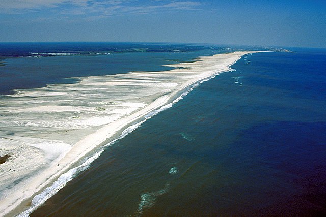
Bordered by the Chesapeake Bay on the west and the Atlantic Ocean on the east, Delmarva has more coastline than California. And that coastline is eroding. Indeed, one particular coastline in Maryland has moved a full quarter-mile in the last 40 years. Off of Maryland’s Atlantic coast, just south of Ocean City, is Assateague Island. Assateague Island National Seashore is one of the most popular national park units on the east coast, with almost 2.5 million visitors in 2020. It is also one of the most dynamic parks in the country, and one of the best examples of how coastal areas can navigate the new climate change reality.
The National Seashore encompasses the majority of the island and most of the water immediately surrounding it. Low, narrow, 37-miles long, and one of the last undeveloped shorelines on the east coast, the island was formed in 1933 after a major storm cut an inlet across the existing peninsula south of Ocean City. Unlike islands made of rock, barrier islands like Assateague are made of sand–sand that is constantly shifting because of winds and waves. “Natural processes are our reason for being,” Hugh Hawthorne, the park’s Superintendent, told me when I visited the island recently.
Hawthorne and I, along with Bill Hulslander, Assateague’s Chief of Resource Management, were standing on the beach talking about the island. Hawthorne pointed over a dune and towards the ocean and explained that the island serves as a buffer for the mainland and mitigates flooding and tidal surge. When a storm rolls in, “the island mutes the energy. Just a little, but sometimes a little is enough,” he said. As an example, Hawthorne added that one of the many reasons Louisiana experiences such bad flooding is that its barrier islands are eroding at an extreme rate and don’t provide as much protection for the mainland as an island like Assateague does.
Aside from the beach, fishing, and hunting, many visitors to Assateague come to watch the abundant wildlife, the most well-known of which are the beautiful wild horses (there are 83 in the seashore’s herd right now, and more elsewhere on the island). Deer and several species of frogs and reptiles also live on the island. Assateague also provides abundant food and a place to rest for thousands of birds on their twice-yearly trans-continental migration.
It’s not just island tourism that helps keep the local economy humming. According to the National Park Service, “the sheltered, nutrient rich waters of the estuary formed by the island provide ideal breeding and spawning habitat for many aquatic species, some of which, like the blue crab, are commercially important to the local area.”
All of these benefits of the island–economic, ecological, recreational–are threatened by climate change. Even though change is the very nature of the seashore, too much change too fast could be devastating. “Some movement is normal,” Hawthorne said, but climate change is speeding things up via sea level rise and more intense storms.
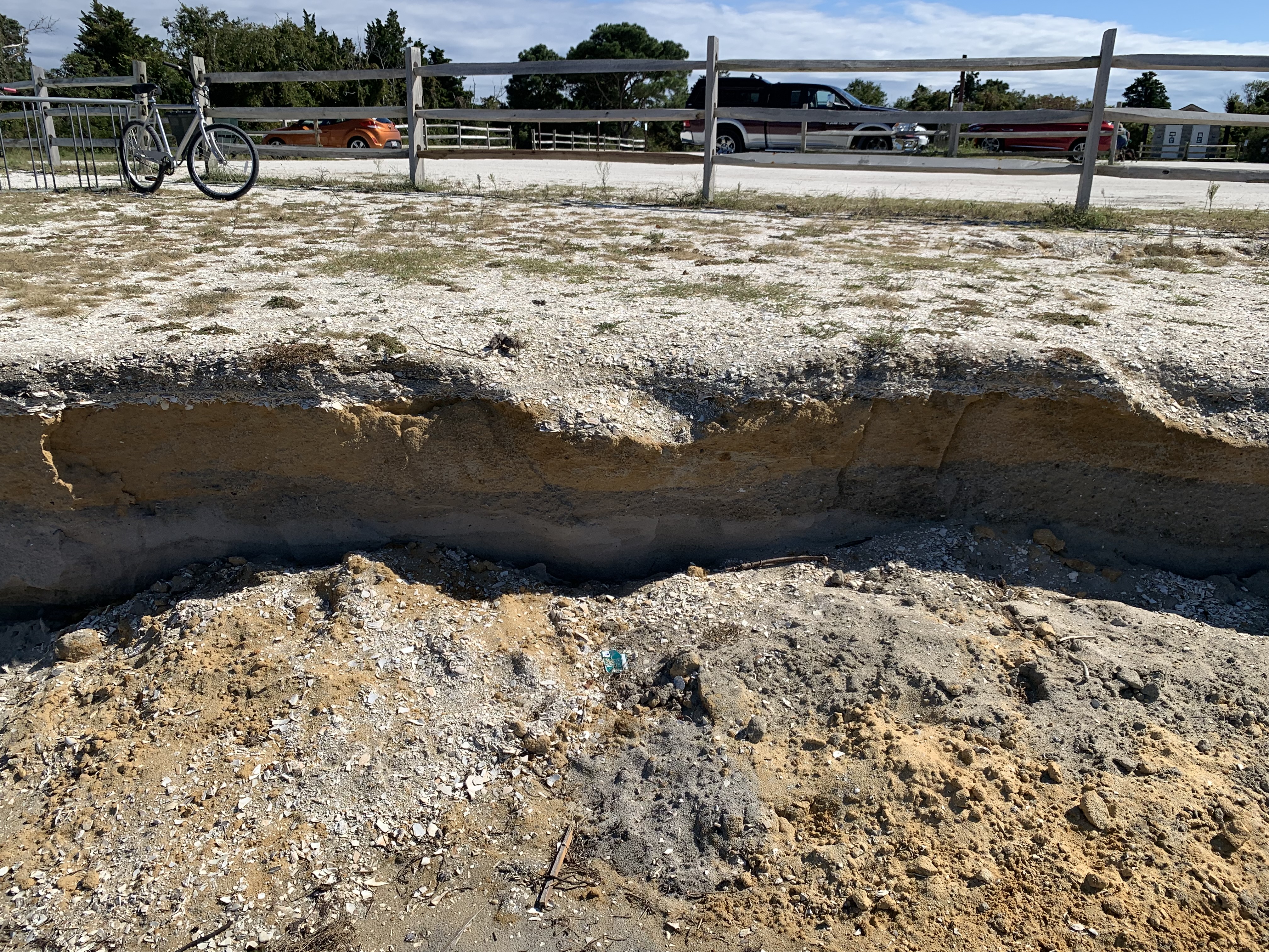
The U.S. Geological Survey (USGS) says that, on the high end, Maryland can expect over two feet of sea level rise by 2050, and according to the National Park Service’s Climate Change Response Program, “rising sea levels can worsen erosion, permanently inundate wetlands, and destroy habitat for diverse wildlife and plants.” I saw firsthand how erosion is wearing away the parking lots at Assateague’s Bayside Campground. A giant chunk had fallen off, exposing more than a foot of clay and soil underneath. It reminded me of the layers in a slice of cake. Eventually, that parking lot will need to be moved further away from the coastline.
As if rising seas weren’t enough, Assateague is also sinking. The sinking, or subsidence, is caused by groundwater withdrawal (water sources for homes and businesses are depleting groundwater, which causes the land to sink) and glacial subsidence (basically, the area is still resettling after the last ice age). Together, subsidence and sea level rise narrow the coastline and erodes dunes, which lessens island’s natural resilience and compounds climate change effects on Assateague, according to Hulslander.
The sea-level rise and subsidence are not localized to Assateague. Scientists at the University of Maryland predict that, by 2050, the southern half of Dorchester County, on Maryland’s Eastern Shore (which is, confusingly, west of Assateague) will be under the Chesapeake Bay.
Rising sea levels combined with more dramatic rainfall mean that intense flooding, already a common issue on Delmarva, will only get worse. A new report by UMD and the Eastern Shore Land Conservancy estimated that, by the 2040s, a 100-year storm will dump an additional 0.5-inch to 1.5-inches of rainfall in 24 hours across the peninsula. Because Delmarva is such a low-lying region, even small amounts of rain can flood roadways and bridges. “You should see this place when it rains...It’s just completely underwater,” Eric, a 32 year-old from Federalsburg, MD told me while he was fishing at a popular spot just off the road in Blackwater.
The Maryland and Virginia Departments of Health frequently issue alerts to stay out of the Chesapeake Bay after heavy rainfall because of harmful bacteria and pollution runoff that inundates the bay, its coastlines, and its rivers. Combined with the erosion, the increased salinity, and the flooding, this represents a major risk to the local economy. All along the Maryland and Virginia shorelines, the forests of the Chesapeake Bay Watershed help filter the drinking water for 13 million people, according to the Chesapeake Bay Foundation, a non-profit focused on protecting the Bay. Additionally, commercial fishing in the Bay supports more than 34,000 jobs in Maryland and Virginia, and accounts for almost $3.5 billion in annual sales.
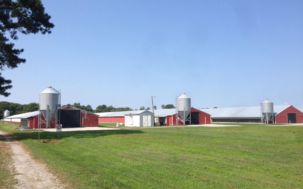
Delmarva, especially in Delaware, is a chicken farming powerhouse. According to the Delmarva Chicken Association, in 2020 Delmarva farmers processed upwards of 4.2 billion pounds of chicken, or almost 10% of all chicken in the US, worth almost $3.5 billion.
Because of its strategic location along the Atlantic Flyway, with the Appalachian Mountains to the west and the Atlantic Ocean to the east, Delmarva is an important stopping point for tens of thousands of birds migrating from Maine to Florida and back again. It’s a long trip and the birds need safe places in protected lands to rest and fuel up before continuing.
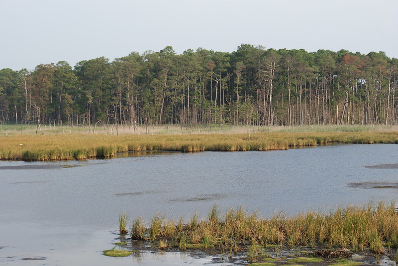
Assateague is one such protected space. Blackwater National Wildlife Refuge, in Maryland’s Dorchester County, is another key sanctuary for migrating birds. Blackwater is a roughly 30 thousand acre National Wildlife Refuge established in 1933 as a sanctuary for migrating waterfowl. Made up of brackish tidal marshes, loblolly pine and hardwood forests, freshwater wetlands and crop lands, Blackwater is one of dozens of wildlife refuges along the Atlantic Flyway, each one of them a critical stepping stone along a thousands mile long journey that migrating birds must make twice-yearly.
Of course, for many birds and animals Delmarva isn’t just a temporary home, it’s where they live year round. Bald eagles tend to only migrate as far south as they need to in order to find prey for hunting, and many bald eagles live in Blackwater year round. In the early 1960s, there were less than 1,000 known bald eagles in all of America. The once thriving population had been decimated due to habitat loss, over-hunting and the pesticide DDT. In 1966, Congress passed the Endangered Species Preservation Act, which empowered the Secretary of the Interior to acquire lands that would further the bird’s conservation. And, in 1972 the EPA outright banned the use of DDT. In one of the most successful acts of conservation in U.S. history, the bald eagle was taken off the endangered species list in 2007. There are now over 315,000 bald eagles, according to a report from earlier this year by the U.S. Fish and Wildlife Service, and Blackwater has the largest population of breeding pairs on the east coast.
Blackwater is not the sole reason our national emblem came back from the brink of extinction. But, as a protected sanctuary and stepping-stone on the birds’ hunting path, and as home to the largest breeding pair population on the east coast, Blackwater was a key player in saving the species and remains a key player in its continued success.
But that continued success is not guaranteed. Blackwater’s marshes, forests, and waterfowl and reptile populations are all at risk due to the continued impacts of climate change. “We are the poster child for sea level rise,” Matt Whitbeck, the Supervisory Wildlife Biologist for the Chesapeake Marshlands NWR Complex (which manages multiple national wildlife refuges in the Delmarva area) told me. “The biggest threat” to the refuge’s health “by far is the steady year by year sea level rise.”
According to a report by the US Geological Survey, sea levels along the Chesapeake Bay coast are expected to be over 3 feet higher than current levels by 2100, which threatens to turn the refuge’s brackish marshes to open saltwater. The increased salinity can kill the refuge’s trees and create what are known as “ghost forests.”
When one part of Blackwater is at risk, it puts the entire refuge at risk. Think of it like pieces of a puzzle. If one piece is missing, then it becomes much harder for Blackwater to support its diverse populations. In an example of beautiful symmetry, sunlight penetrates to the bottom of the refuge’s shallow water, which helps aquatic plants to thrive. Fish and small crustaceans use the thick plants as a nursery–plants provide food and good hiding spots–while, in turn, larger crabs, waterfowl, and raptors (like the bald eagle) take advantage of this fact and hunt in the area. The marshes also, mainly through the roots of said aquatic plants, filter water pollution, decrease erosion, and help protect the coastline from tides.
The U.S. Fish and Wildlife Service takes an active role in trying to fight back against the changing landscape before it is irretrievably lost. “We’re good about getting dirt under our fingernails,” Whitbeck said.
In fact, because of its many partnerships with scientists and researchers, Blackwater is one of the most influential public lands in the country. “The thing I’m most proud of,” Whitbeck continued, “is our partnerships with academics and the scientific community.”
For instance, the Surface Elevation Table (SET) was invented by two USGS scientists conducting marshland research in Louisiana and at Blackwater. According to the USGS, it’s currently in use in some 22 different countries and is one of the best tools scientists have for measuring sea level rise and elevation change in wetlands around the world.
Co-located within the national wildlife refuge is Harriet Tubman National Historical Park. The park aims to tell Tubman’s story and to preserve “the same landscapes that Tubman used to carry herself and others away from slavery.” When Tubman’s owner died, in 1849, his widow began planning to sell their family’s enslaved people, and Tubman worried that her own family would be split up. “There was one of two things I had a right to", she explained later, "liberty or death; if I could not have one, I would have the other." In September of that year, Tubman escaped with her two brothers. Because her owner had hired her out to work for another family, it wasn’t until two or three weeks later that Tubman’s living owner, Eliza Brodess, realized she was missing and put a notice in the Cambridge Democrat, offering $100 for each returned slave. You can see a scaled-up copy of that notice inside the visitor center.
After her original escape, Tubman made approximately 13 more trips back to Maryland, rescuing 70 people, whose names now hang on those posters inside the visitor center. To be able to come even remotely close to understanding how terrifying those trips must have been, you have to head a few miles south of the National Historical Park to the Tubman Road Trail. In the 1600s, several families first settled this area and cleared much of the land for farming. The road winds through what would have been old homesteads. Although this specifical trail wasn’t necessarily a route on the Underground Railroad, it was near this area, in 1822, that Harriet Tubman (nee` Ross) was born to her enslaved parents, Harriet Green and Ben Ross. At one point while hiking the trail, I stopped and looked around. Every direction was the same. Forest and marsh everywhere. Infinite hazards. Total silence. Complete isolation. If Tubman had been caught on any of her trips, she would have been brutally tortured and most likely killed. Standing on the Tubman trail, the reality of that hits home. “Look around you. Where do you go?” Walter Smiley had told me, shaking his head in disbelief.
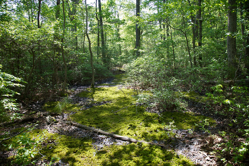
These woods–this crucial part of American history– are threatened by flooding, erosion, by salt-water intrusion, even by wildfires. There are some encouraging signs that the folks in Delmarva won’t just sit back and let climate change wreck their homes and livelihoods but, unfortunately, Delmarva is a harbinger for the rest of the US in another way: it’s running out of time to make any meaningful difference in the fight against climate change.
Of course, the most impactful changes will come at a societal level: energy generation, transportation, manufacturing. But local groups are still trying to do their part. The Eastern Shore Land Conservancy is one of the largest conservation focused non-profits in Delmarva. Sara Ramotnik, a policy manager for ESLC, told me that ESLC’s Delmarva Oasis program, though in its infancy, has grand ambitions: to protect 50% of Delmarva’s land by 2030 and to become a national model for change while doing so. If successful, the Oasis will protect from development the largest contiguous block of land in the mid-Atlantic.
Obviously, challenges abound. Working across three different states and multiple counties is a recipe for bureaucratic morass. But the biggest challenge? Time. Said Ramotnik, “The clock is ticking every single day.”